|
|

|
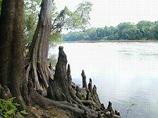
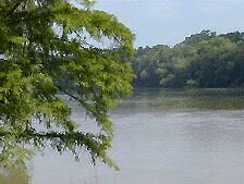
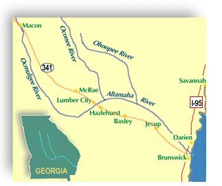
In 1999 the Mexico-based Western Hemisphere Shorebird Reserve Network recognized the Altamaha River Delta in Glynn and McIntosh Counties as a major reserve for shorebirds, one of only 40, highlighting its importance as a stopover for migratory and wintering birds traveling between the Artic and South America. The Georgia Department of Natural Resources estimates this area supports at least 55,000 species of seabirds and shorebirds annually, stating "There are very few places as valuable to such a large and diverse number of coastal birds in all the southeast United States." 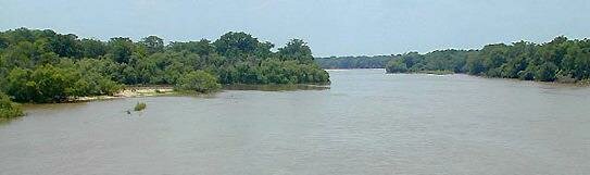 Appling/Tattnall County Line The Altamaha River is a little known paradise for paddling, bird watching, camping, fishing, powerboating, and hiking. Photographers, artists, writers, and nature-lovers of all ages may enjoy the abundance of this pristine waterway. Boat ramps, picnic areas and hiking trails along the waterway are provided by state, federal and county facilities. As we explore this river we will share with you our information, hoping to blaze a trail of new awareness thru firsthand experience. Already I can report that, on a recent Sunday afternoon in Big Hammock WMA, we spotted 2 deer, 8 wild hogs, a wild turkey, 6 white ibis, a great white heron, a map turtle, a rattlesnake and a king snake within a 2 hour period. One can only imagine the adventures yet to come as we venture further west into Appling County and beyond. Our challenge is to enjoy, protect and preserve this treasure for ourselves and for those who follow. Support the Altamaha Riverkeepers: "We ALL live downstream!" |
|||
 Tattnall County |
Wayne County |
||
|
History Jesup, GA River Access Wetlands Wayne County-Jesup Georgia Chamber of Commerce Coastal Georgia Tourism Information Golden Isles Navigator The Guide to Georgia's Golden Isles 1PLs | Loans Nearby |
||